Thanks to Our
Sustaining Members

(Click logos for more information)


and


Restaurant of Perth

and


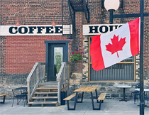
Hourglass Cafe

and


Foodsmiths

and


Rideau Valley Conservation Authority

and


Prodecal


and


(Click logos for more information)

Tay River Indicators ~ 2004 Update

(See prior narrative in Tay Indicators 03)


      Notes:

        1. Main Tay measurements start at Bolingbroke and continue eastward.
            G.T. = Glen Tay
            Lag. = Downstream of Perth sewage lagoon
            P.E. = Port Elmsley
            Rudds. = Ruddsdale Creek
            Snye = Scotts Snye
        2. Grant's Creek measurements start at Pike Lake Dam and continue eastward.
        3. E.coli provincial water quality standards are:
            >0 CFU/100ml - unsafe for drinking
            >100 CFU/100ml - unsafe for water contact (i.e: swimming)
    CLICK TO:
    JOIN US

    and/or
    DONATE


Site designed and maintained pro bono by Colmar

FRIENDS OF THE TAY WATERSHED
Website content is subject to Copyright protection. This work is licensed under
Creative Commons Attribution-NonCommercial 3.0 Unported License.
Creative Commons License
Click for content sharing information and restrictions.
 
Attribution statement requested for materials used for non-commercial purposes from this website:
"Courtesy of Friends of the Tay Watershed ~ www.taywatershed.ca (no endorsation implied)"